
David Payne's Sundial Trail in Norfolk.
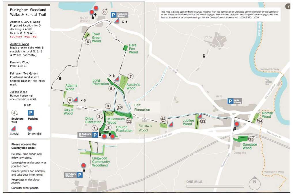
The map above shows the scale of this most imaginative project. David writes:
THE FAIRHAVEN SUNDIAL (Built 2015)
Classification and Description: Equatorial sundial with noon
mark and altitude calendar. The dial face is drawn on the equatorial plane
(parallel to the equator of the earth at the given latitude of the sundial
location)
1. It is the most important of all the sundial planes and the most accurate
2. It has a linear scale of 15° per hour division (the earth’s rotational rate)
3. Time indicated is the azimuth of the sun’s position in the sky (spring /
summer on the top dial face and autumn / winter on the underneath dial face)
4. It is a primary inclining sundial
5. Together with the polar sundial, it has a universal dial face, i.e
the same dial face divisions regardless of location
6. Same sundial classification as the armillary sphere
7. Other examples of the equatorial sundial can be seen at: a. St Catherine’s
Dock, London b. Greenwich – The iconic dolphin sundial is a mean time equatorial
sundial and reads GMT direct
It is very accurate
THE ALTITUDE CALENDAR AND NOON MARK
Description: The centre of the dial face has a cylindrical
stainless steel 2” high pin
When the shadow of this pin aligns with the parallel lines each side of the pin,
the sun’s position is due south, i.e noon
The time of the year can be found by observing the length of the pin shadow and
reading the date scale beside these parallel lines.
Further information will be placed here as it becomes available.
David's presentation at the 2014 BSS Conference about the manufacture and installation of the Cube Dial
Use the arrows to select the slides
We are much indebted to David Payne for permission to show this presentation
[Back]